


Krain Twp. Voting District, Stearns County, Minnesota
About
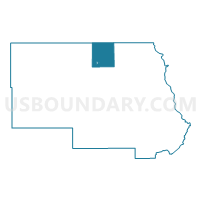
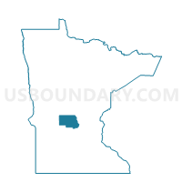
Outline

Summary
| Unique Area Identifier | 604441 |
| Name | Krain Twp. Voting District |
| County | Stearns County |
| State | Minnesota |
| Area (square miles) | 44.08 |
| Land Area (square miles) | 43.35 |
| Water Area (square miles) | 0.72 |
| % of Land Area | 98.36 |
| % of Water Area | 1.64 |
| Latitude of the Internal Point | 45.71453900 |
| Longtitude of the Internal Point | -94.58520610 |
Maps

Graphs
Select a template below for downloading or customizing gragh for Krain Twp. Voting District, Stearns County, Minnesota


Neighbors
Neighoring Voting District (by Name) Neighboring Voting District on the Map
- Albany Twp. Voting District, Stearns County, MN
- Avon Twp. Voting District, Stearns County, MN
- Elmdale Township Voting District, Morrison County, MN
- Grey Eagle Twp. Voting District, Todd County, MN
- Holding Twp. Voting District, Stearns County, MN
- Millwood Twp. Voting District, Stearns County, MN
- Oak Twp. Voting District, Stearns County, MN
- St. Anthony Voting District, Stearns County, MN
Top 10 Neighboring County Subdivision (by Population) Neighboring County Subdivision on the Map
- Avon township, Stearns County, MN (2,294)
- Holding township, Stearns County, MN (1,139)
- Elmdale township, Morrison County, MN (1,010)
- Krain township, Stearns County, MN (981)
- Albany township, Stearns County, MN (980)
- Millwood township, Stearns County, MN (972)
- Grey Eagle township, Todd County, MN (638)
- Oak township, Stearns County, MN (595)
- St. Anthony city, Stearns County, MN (86)
Top 10 Neighboring Place (by Population) Neighboring Place on the Map
Top 10 Neighboring Unified School District (by Population) Neighboring Unified School District on the Map
- Albany Public School District, MN (8,870)
- Melrose Public School District, MN (8,817)
- Holdingford Public School District, MN (4,795)
- Upsala Public School District, MN (2,038)
Top 10 Neighboring State Legislative District Lower Chamber (by Population) Neighboring State Legislative District Lower Chamber on the Map
- State House District 14A, MN (46,214)
- State House District 14B, MN (40,101)
- State House District 11B, MN (39,156)
- State House District 12B, MN (38,869)
- State House District 13A, MN (38,763)
Top 10 Neighboring State Legislative District Upper Chamber (by Population) Neighboring State Legislative District Upper Chamber on the Map
- State Senate District 14, MN (86,315)
- State Senate District 12, MN (79,560)
- State Senate District 11, MN (76,648)
- State Senate District 13, MN (76,590)
Top 10 Neighboring 111th Congressional District (by Population) Neighboring 111th Congressional District on the Map
- Congressional District 6, MN (759,478)
- Congressional District 8, MN (660,342)
- Congressional District 7, MN (625,512)
Top 10 Neighboring Census Tract (by Population) Neighboring Census Tract on the Map
- Census Tract 7808, Morrison County, MN (4,306)
- Census Tract 104.02, Stearns County, MN (3,947)
- Census Tract 105, Stearns County, MN (3,691)
- Census Tract 104.03, Stearns County, MN (3,045)
- Census Tract 7908, Todd County, MN (1,897)
Top 10 Neighboring 5-Digit ZIP Code Tabulation Area (by Population) Neighboring 5-Digit ZIP Code Tabulation Area on the Map
- 56307, MN (5,157)
- 56310, MN (5,120)
- 56340, MN (2,288)
- 56331, MN (2,019)
- 56336, MN (1,514)
- 56318, MN (1,238)